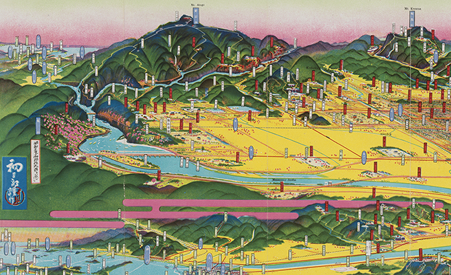
京都鳥瞰圖
Title
京都鳥瞰圖
Title(Kana)
キョウト チョウカンズ
Title(Romanized)
Kyōto chōkanzu.
Alternative Title
異なりアクセスタイトル:京都鳥瞰図
収録著作情報:伏見桃山御陵
収録著作情報:大極殿
収録著作情報:男山及ヒ山崎附近
収録著作情報:嵯峨
収録著作情報:二條離宮
収録著作情報:上賀茂神社
収録著作情報: 京都御所
Language
日本語
Creator
吉田, 初三郎
平安考古學會
Creator(Kana)
ヨシダ, ハツサブロウ
ヘイアン コウコ ガッカイ
Size
地図1枚 (8図) : 多色刷 ; 64×132cm
Place of Publication
京都
Publisher
井出時秀
Publication Year(Literal)
1915.10
Publication Year
1915
Description
注記 地図資料: [縮尺表示なし]
注記 内匡: 57×124cm
Material Type
地図資料
Geolocation
京都府
Bibliographic ID
Material ID
Call No
YG/7/GC156/Ky
Collection
-

Yoshida Hatsusaburō Bird’s-eye View Maps
Collection of images of the bird’s-eye view maps made by Yoshida Hatsusaburō (1884–1955) and other artists of his time.