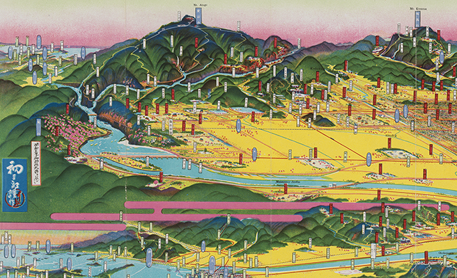
撫養町
Title
撫養町
Title(Kana)
ムヤチョウ
Title(Romanized)
Muyachō.
Alternative Title
その他のタイトル:撫養町鳥瞰圖
Language
日本語
Creator
城下, 豐榮
稲垣, 滿一郎
Creator(Kana)
シロシタ, ホウエイ
イナガキ, マンイチロウ
Size
地図1舗 : 多色刷 ; 18×78cm (折りたたみ18cm)
Place of Publication
撫養町
Publisher
撫養町役場
Publication Year(Literal)
[19--]
Description
注記 地図資料: [縮尺表示なし]
注記 タイトルは表紙による
注記 その他のタイトル「撫養町鳥瞰圖」は地図の標題による
注記 責任表示のヨミは推量形
注記 内匡: 17×56cm
注記 図中に「撫養町と鳴門觀潮」「豐榮作(城下)」とあり
注記 「昭和拾壹年七月拾八日由良要塞司令部檢閲濟」とあり
Material Type
地図資料
Geolocation
徳島県
Bibliographic ID
Material ID
Call No
YG/7/GC245/Na
Collection
-

Yoshida Hatsusaburō Bird’s-eye View Maps
Collection of images of the bird’s-eye view maps made by Yoshida Hatsusaburō (1884–1955) and other artists of his time.