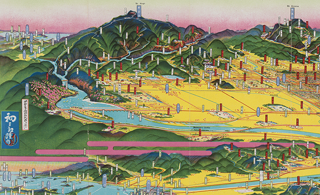
八幡市
Title
八幡市
Title(Kana)
ヤハタシ
Title(Romanized)
Yahatashi.
Alternative Title
その他のタイトル:八幡市鳥瞰圖
Language
日本語
Creator
吉田, 初三郎
永井, 明
Creator(Kana)
ヨシダ, ハツサブロウ
ナガイ, アキラ
Creator Alternative
初三郎
Creator Alternative(Kana)
ハツサブロウ
Size
地図1舗 : 多色刷 ; 20×101cm (折りたたみ20cm)
Place of Publication
[八幡 (福岡縣)]
Publisher
八幡市役所
八幡商工會議所
Publication Year(Literal)
1934.4
Publication Year
1934
Description
注記 地図資料: [縮尺表示なし]
注記 タイトルは表紙による
注記 その他のタイトルは地図の標題による
注記 内匡: 17×75cm
注記 表紙: 初三郎作の絵入り
注記 表紙裏面: 写真入り (1枚)
注記 地図裏面: 「繪に添えて一筆」ほか案内文, 写真入り (8点)
注記 昭和8年12月16日下関要塞司令部許可済 (鳥瞰図枠外には「昭和8年11月17日下関要塞司令部検閲済」とあり)
Material Type
地図資料
Geolocation
福岡県
Bibliographic ID
Material ID
Call No
YG/7/GC265/Ya
Collection
-

Yoshida Hatsusaburō Bird’s-eye View Maps
Collection of images of the bird’s-eye view maps made by Yoshida Hatsusaburō (1884–1955) and other artists of his time.