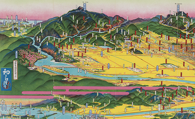
笠松町鳥瞰圖
Title
笠松町鳥瞰圖
Title(Kana)
カサマツチョウ チョウカンズ
Title(Romanized)
Kasamatsuchō chōkanzu.
Alternative Title
異なりアクセスタイトル:笠松町鳥瞰図
収録著作情報:笠松町ノ位置ト沿線圖
Language
日本語
Creator
吉田, 初三郎
Creator(Kana)
ヨシダ, ハツサブロウ
Size
地図1枚 (2図) : 多色刷 ; 18×39cm (折りたたみ18cm)
Place of Publication
[出版地不明]
Publisher
[出版者不明]
Publication Year(Literal)
[19--]
Description
注記 著作権並版権所有者: 京都 吉田初三郎
注記 印刷所: 京都 觀光社出版部
注記 [縮尺決定不能]
注記 地図の大きさ: 16×27cm
注記 裏面: 通信欄と写真など
Material Type
地図資料
Geolocation
岐阜県
Bibliographic ID
Material ID
Call No
YG/7/GC124/Ka
Collection
-

Yoshida Hatsusaburō Bird’s-eye View Maps
Collection of images of the bird’s-eye view maps made by Yoshida Hatsusaburō (1884–1955) and other artists of his time.