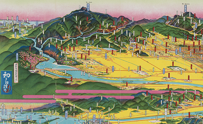
關東震災全地域鳥瞰圖繪
Title
關東震災全地域鳥瞰圖繪
Title(Kana)
カントウ シンサイ ゼンチイキ チョウカン ズエ
Title(Romanized)
Kantō shinsai zenchiiki chōkan zue.
Alternative Title
その他のタイトル:関東に於ける大震災大火災鳥瞰圖
異なりアクセスタイトル:関東震災全地域鳥瞰図絵
Language
日本語
Creator
吉田, 初三郎
Creator(Kana)
ヨシダ, ハツサブロウ
Size
地図1枚 : 多色刷 ; 26×109cm (折りたたみ26cm)
Place of Publication
[大阪]
Publisher
大阪朝日新聞社
Publication Year(Literal)
1924.9
Publication Year
1924
Description
注記 その他の標題は画面右上の初三郎筆による
注記 [縮尺決定不能]
注記 裏面: 「震災後の一年間」(写真入り)
注記 『大阪朝日新聞』大正13年9月15日(第15369號)附録
Material Type
地図資料
Bibliographic ID
Material ID
Call No
YG/7/GC41/Yo
Collection
-

Yoshida Hatsusaburō Bird’s-eye View Maps
Collection of images of the bird’s-eye view maps made by Yoshida Hatsusaburō (1884–1955) and other artists of his time.