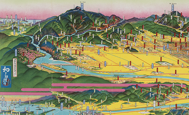
美唄市鳥瞰圖
Title
美唄市鳥瞰圖
Title(Kana)
ビバイシ チョウカンズ
Title(Romanized)
Bibaishi chōkanzu.
Alternative Title
表紙タイトル:美唄市
異なりアクセスタイトル:美唄市鳥瞰図
Language
日本語
Creator
吉田, 初三郎
Creator(Kana)
ヨシダ, ハツサブロウ
Size
地図1枚 : カラー ; 19×52cm (折りたたみ19cm)
Place of Publication
美唄
Publisher
美唄市
Publication Year(Literal)
[1952]
Publication Year
1952
Description
注記 著作權者: 京都市祇園南鳥居前・吉田初三郎
注記 版權所有者: 京都市祇園南鳥居前・阿瀬庄太郎
注記 作製: 京都市祇園・觀光社
注記 出版年は裏面記載中の「財政」欄による
注記 [縮尺決定不能]
注記 裏面: 市勢概要など, 繪に添へてひとふで(吉田初三郎), 美唄市全圖
注記 地図は折込・見開き式で、全体は図書仕立て
Material Type
地図資料
Geolocation
北海道
Bibliographic ID
Material ID
Call No
YG/7/GC7/Bi
Collection
-

Yoshida Hatsusaburō Bird’s-eye View Maps
Collection of images of the bird’s-eye view maps made by Yoshida Hatsusaburō (1884–1955) and other artists of his time.