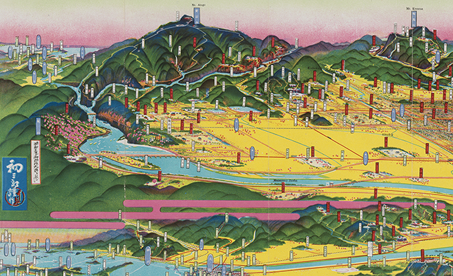
愛知縣鳥瞰圖
Title
愛知縣鳥瞰圖
Title(Kana)
アイチケン チョウカンズ
Title(Romanized)
Aichiken chōkanzu.
Alternative Title
表紙タイトル:愛知縣鳥瞰圖 : 昭和二年陸軍特別大演習記念
異なりアクセスタイトル:愛知県鳥瞰図
Language
日本語
Creator
吉田, 初三郎
吉田初三郎出版部
Creator(Kana)
ヨシダ, ハツサブロウ
ヨシダ ハツサブロウ シュッパンブ
Size
地図1枚 : 多色刷 ; 18×99cm (折りたたみ19cm)
Place of Publication
[名古屋]
Publisher
愛知縣
Publication Year(Literal)
1927.11
Publication Year
1927
Description
注記 [縮尺決定不能]
注記 著作權所有者兼發行印刷者: 吉田初三郎
注記 地図の大きさ: 18x77cm
注記 裏面: 愛知縣御案内, 愛知縣概觀
注記 表紙裏面: 愛知縣交通畧圖
Material Type
地図資料
Geolocation
愛知県
Bibliographic ID
Material ID
Call No
YG/7/GC131/Ai
Collection
-

Yoshida Hatsusaburō Bird’s-eye View Maps
Collection of images of the bird’s-eye view maps made by Yoshida Hatsusaburō (1884–1955) and other artists of his time.