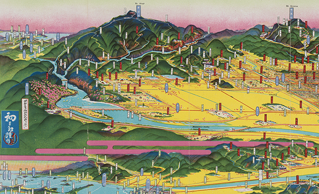
長門峡全渓圖
Title
長門峡全渓圖
Title(Kana)
チョウモンキョウ ゼンケイズ
Title(Romanized)
Chōmonkyō zenkeizu.
Alternative Title
表紙タイトル:長門峡鳥瞰圖
異なりアクセスタイトル:長門峡全渓図
異なりアクセスタイトル:長門峡鳥瞰図
Language
日本語
Creator
吉田, 初三郎
Creator(Kana)
ヨシダ, ハツサブロウ
Size
地図1枚 : 多色刷 ; 19×98cm (折りたたみ19cm)
Place of Publication
萩町
Publisher
長門峡管理組合
白石信夫
藤川東輔 (發賣)
Publication Year(Literal)
1925.3
Publication Year
1925
Description
注記 著作權所有者兼發行者: 吉田初三郎
注記 印刷所: バーザイビュー社
注記 地図の大きさ: 18×77cm
注記 [縮尺表示なし]
注記 表紙: 初三郎作の絵入り
注記 表紙裏面: 題字鐵道省運輸局種田虎雄閣下筆, 写真入り(4点)
注記 地図裏面: 「名勝長門峡案内」「繪に添へて一筆」, 写真入り(11点)
Material Type
地図資料
Geolocation
山口県
Bibliographic ID
Material ID
Call No
YG/7/GC227/Ha
Collection
-

Yoshida Hatsusaburō Bird’s-eye View Maps
Collection of images of the bird’s-eye view maps made by Yoshida Hatsusaburō (1884–1955) and other artists of his time.